
Maps
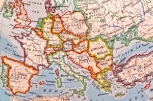
QFHS has a map collection of about 2000 items. Approximately half of the maps relate to Queensland, with some dating from 1842.
Type of Maps
The collection has the following types of physical maps:
Cadastral
Shows property boundaries and subdivisions, areas, and landowners
Parish
Shows civil parishes, land owners, land boundaries, and land usage.
Topographic
Shows roads, rivers, built-up areas, contours, and height information
Thematic
Shows specific features such as forests, agriculture, railways, government boundaries
Road Atlas
Shows regional transportation systems, distances, and communications
Tourist
Shows places of interest, including national parks, forest reserves, camping areas, major industries and historical sites
QFHS has a collection of digital maps; search the Library Catalogue for relevant CDs.
The Map Collection
The Map Collection consists of map cabinets, a plan cabinet, tourist maps, road maps, National Geographic country maps and more in the relevant compactus.
The contents of the cabinets:
Cabinet 1
- Historic Brisbane maps
- Brisbane suburbs
- Queensland Topographic
- Geological Survey
- Miscellaneous maps of NSW, WA, TAS, and SA
- Maps showing Brisbane flood boundaries, stock routes, the 1864 freight systems, goldfields, and artesian bores
Cabinet 2
- Queensland Parish maps showing towns, properties, land owners, roads, railways, creeks. These 570 Parish maps cover the coastal areas of Queensland and some parts of the Darling Downs, Maranoa, and Mitchell districts
Cabinet 3
- Military survey maps of England, Scotland and Wales for the period 1841–1870
- Miscellaneous Irish maps
- Topographic maps of various towns in the United Kingdom, dated around 1840
Cabinet 4
- Topographic maps of Germany, 1930 series with a scale of 1 cm: 1 km
Cabinet 5
- Queensland Two Mile and Four Mile series
- Queensland irrigation
- Commonwealth Electorates
- Local Government areas
On the top of each map cabinet, you will find a folder detailing the maps in that particular cabinet.
For a more detailed description, see Guide to QFHS Map Collection.
Gazetteers
Gazetteers of the United Kingdom and Germany are also held. Check the library catalogue for details of gazetteers on CD, microfiche, and microfilm.
If you have an enquiry about our collection, contact Maps.
The Library Assistants on duty at the Family History Research Centre can also provide assistance.
